Wednesday, November 19, 2008


Tuesday, November 18, 2008
A View From the Top
HERE ARE PHOTOS taken from the top of the old South Side National Bank building, located on the corner of Grand and Gravois Avenues in Saint Louis, Missouri.
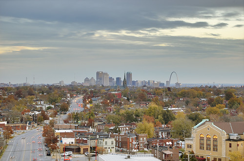
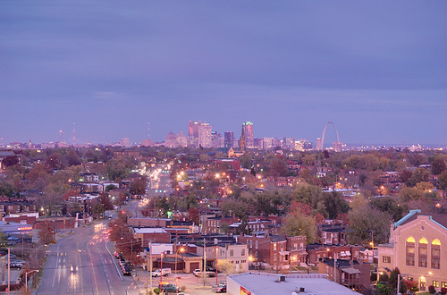
Looking northeast up Gravois Avenue to downtown. The Gateway Arch is about four miles away.
The South Side National Bank building is an Art Deco gem, dating from 1928, and has recently been redeveloped into condominiums and renamed the South Side Tower. It is 108 feet tall, and I completely neglected to take a picture of the building itself! My thanks to Leigh Maibes, Realtor, who represents this property and kindly gave me permission to photograph from here. I met Leigh while visiting another of her properties, the Sugarloaf Indian Mound.
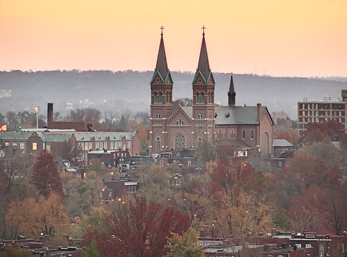
⅞ of a mile southeast of the tower is Saint Anthony of Padua Church, completed in 1910, and home of the Order of Friars Minor (Franciscans of the Sacred Heart Province of Saint Louis and Chicago). The ridge behind the church is in Illinois, and you can see a bit of the Mississippi River to the left of the church.
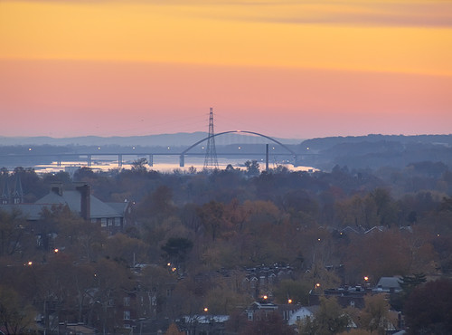
The Jefferson Barracks Bridge (constructed 1983-1992), crossing the Mississippi River between Illinois on the left and Missouri on the right. It is located 7-½ miles south of the tower. The bridge is named after the Jefferson Barracks military post, active 1826-1946, and the Jefferson Barracks National Cemetery.
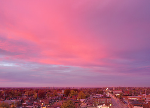
It was a cold, windy, cloudy day, not promising for colorful photography. But sunset was glorious!
For those interested in digital photography, this and the next six photos were taken with the camera white balance fixed to 'Daylight'. Cameras set to automatic white balance will usually attempt to subtract out these colors, making photos taken during this time of day sometimes disappointing.
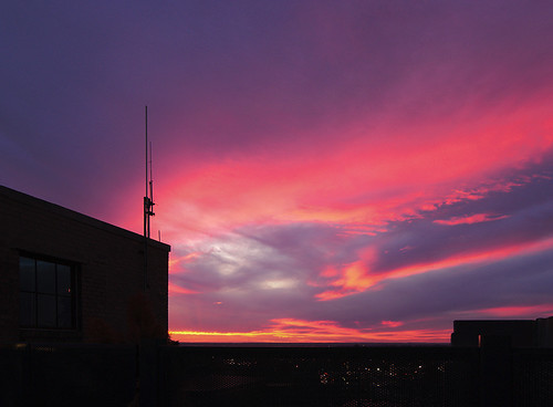


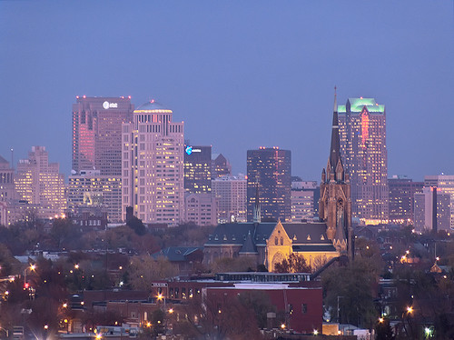
The Oratory and downtown, with electric lighting.
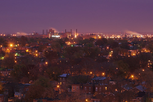
Night falls on the Anheuser-Busch Brewery, 1-⅔ miles to the east.
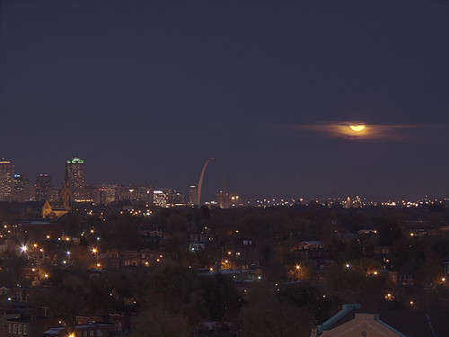
The moon rises. These photos were taken on November 13th, 2008, between 4:41 p.m. and 5:12 p.m.
Click here for a map of the building and landmarks.
Looking northeast up Gravois Avenue to downtown. The Gateway Arch is about four miles away.
The South Side National Bank building is an Art Deco gem, dating from 1928, and has recently been redeveloped into condominiums and renamed the South Side Tower. It is 108 feet tall, and I completely neglected to take a picture of the building itself! My thanks to Leigh Maibes, Realtor, who represents this property and kindly gave me permission to photograph from here. I met Leigh while visiting another of her properties, the Sugarloaf Indian Mound.
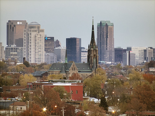
Saint Francis de Sales Oratory, built in 1908, about 1-¼ miles to the northeast.
⅞ of a mile southeast of the tower is Saint Anthony of Padua Church, completed in 1910, and home of the Order of Friars Minor (Franciscans of the Sacred Heart Province of Saint Louis and Chicago). The ridge behind the church is in Illinois, and you can see a bit of the Mississippi River to the left of the church.
The Jefferson Barracks Bridge (constructed 1983-1992), crossing the Mississippi River between Illinois on the left and Missouri on the right. It is located 7-½ miles south of the tower. The bridge is named after the Jefferson Barracks military post, active 1826-1946, and the Jefferson Barracks National Cemetery.
It was a cold, windy, cloudy day, not promising for colorful photography. But sunset was glorious!
For those interested in digital photography, this and the next six photos were taken with the camera white balance fixed to 'Daylight'. Cameras set to automatic white balance will usually attempt to subtract out these colors, making photos taken during this time of day sometimes disappointing.
Sunset is the traditional time of day to pray Vespers, which has the character of thanksgiving.
Looking north up Grand Avenue, with Saint Pope Pius V Church (dating from 1916), four blocks north of the tower.
Zooming up Grand Avenue, we see the Saint Louis University medical complex, about 2 miles away. On the right is the Compton Hill Water Tower: photos taken from this tower are here and here.
I used two separate cameras for this photo essay, and there is some inconsistency on how these cameras represent color.
Looking again up Gravois towards downtown; salmon skies illumine the buildings.
The Oratory and downtown, with electric lighting.
Night falls on the Anheuser-Busch Brewery, 1-⅔ miles to the east.
The moon rises. These photos were taken on November 13th, 2008, between 4:41 p.m. and 5:12 p.m.
Click here for a map of the building and landmarks.
Monday, November 17, 2008
The Wealth of the Church
SAINT LAWRENCE, when ordered by authorities to turn over the wealth of the Church, gathered together the sick and poor of Rome, these being the Church's true wealth.
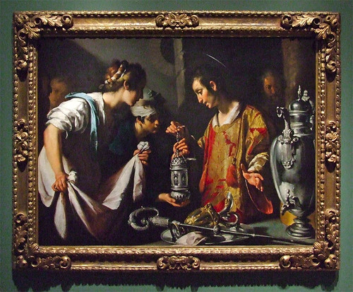
Saint Lawrence, selling off treasures to feed the poor; photo taken at the Saint Louis Art Museum.
The 2008 annual report of the Archdiocese of Saint Louis is now online.
According to the report, 32% of the Archdiocese's expenses go towards serving the sick and poor via Catholic Charities, while 22% goes to education.
Saint Lawrence, selling off treasures to feed the poor; photo taken at the Saint Louis Art Museum.
The 2008 annual report of the Archdiocese of Saint Louis is now online.
According to the report, 32% of the Archdiocese's expenses go towards serving the sick and poor via Catholic Charities, while 22% goes to education.
A relatively small amount of expenses goes towards normal parish life, but this is as it should be.
Saturday, November 15, 2008
Lost Catholic Saint Louis
A MAP, showing closed parishes in the City of Saint Louis, Missouri. Blue markers show approximate location of former churches; the outline shows the city boundary. But this is incomplete, and shows only diocesan churches of the Latin Rite, and fails to include churches belonging to religious orders, such as the Jesuit's old Saint Francis Xavier church, nor does it show closed Catholic parishes of the Eastern Rites.
Some of these churches vanished more than a century ago, erased by the growth of city industry and business, such as Immaculate Conception, downtown; or Our Lady of Czestochowa in the near south side; Saint Bonaventure was located at what is now Busch Stadium. Saint Malachy and Saint Elizabeth, among others, were wiped off the map by "urban renewal", while Saint Michael was destroyed for Interstate highway construction.
Readers are no doubt aware of the great changes of the past six decades — some demographic, others institutional — which led to the bulk of the closures. Many of these closures occurred within our own decade.
Source.
Some of these churches vanished more than a century ago, erased by the growth of city industry and business, such as Immaculate Conception, downtown; or Our Lady of Czestochowa in the near south side; Saint Bonaventure was located at what is now Busch Stadium. Saint Malachy and Saint Elizabeth, among others, were wiped off the map by "urban renewal", while Saint Michael was destroyed for Interstate highway construction.
Readers are no doubt aware of the great changes of the past six decades — some demographic, others institutional — which led to the bulk of the closures. Many of these closures occurred within our own decade.
Source.
Thursday, November 13, 2008
"Saint Paul's Journey"
Announcement, from a correspondent:
will perform
“Saint Paul’s Journey”
featuring nationally renowned Catholic actor
Kevin O’Brien
On Sunday, November 16 at 2:00 p.m., in
Mindszenty Hall, St. Mary of Victories Church, 744 South 3rd Street
ADMISSION FREE! DON’T MISS OUT!
Lunch can be purchased from noon onwards
Subscribe to:
Posts (Atom)
