
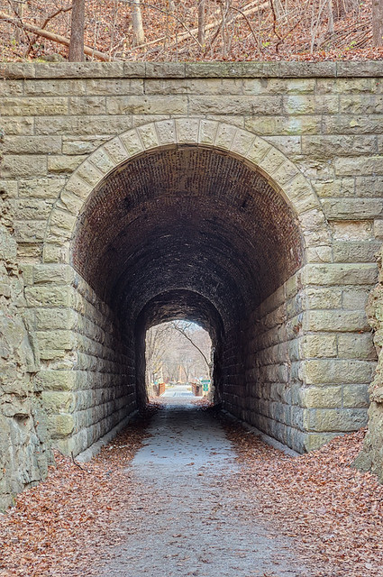
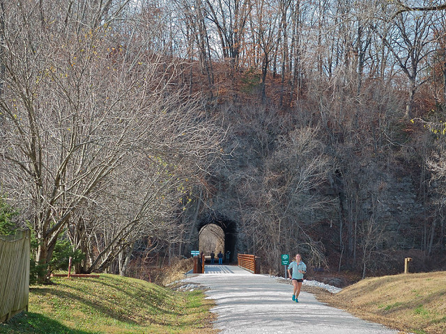
A former railroad tunnel, constructed in 1892, on the Katy trail, at Rocheport, Missouri. The Katy is a 240 mile long state park that consists of the right-of-way of the former Missouri-Kansas-Texas Railroad, and is now a hiking and biking path. This trail, which goes from Clinton in west-central Missouri, to Machens, northeast of Saint Charles, is largely flat and follows the floodplain of the Missouri River throughout much of its route. This is the only tunnel on the route: here the trail veers north of the river before crossing it and leaving the river valley behind at Boonville. Above the tunnel, after an exhausting climb, is an observation platform which offers views of the river below.
Under normal law, when a railroad abandons a line, the land reverts to the adjoining property owners: the railroad usually does not own the land, but has a legal easement on the property belonging to others. If the railroad is needed again in the future — closure is often due to transient financial reasons and not due to longer-term need — it would require a controversial or even tyrannical use of power to get it re-established. But under the federal railbank legal framework, this former railroad must remain linked to the existing railroad network; the government pays for maintaining the infrastructure such as bridges and this tunnel, pays claims to adjoining landowners who own the easements upon which the trail is built, while giving railroads the right to restore train service if needed in the future. While building roads such as this one is usually seen as a legitimate exercise of the power of eminent domain, it is both politically expedient and prudent to keep the status quo of this road instead of attempting to create a new one elsewhere in the future.
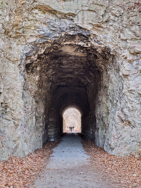
While the western end of the tunnel is a pleasant Romanesque arch, with brick and rustic stones supporting the soil above it, the eastern end at Rocheport is naturalistic and is cut through the native stone. In this photo you can see extensive nodules of chert or flint in the limestone rock. According to the journals of the famed Lewis and Clark Corps of Discovery:
“. . . a Short distance above the mouth of Creek, is Several Courious paintings and carving on the projecting rock of Limestone inlade with white red & blue flint, of a verry good quallity, the Indians have taken of this flint great quantities.”According to the journals, “uncouth paintings of animals,” known as manitous, painted or carved by the Indians, are or were visible on this cliff face, and on many cliffs in this region. Certainly more modern carvings can be seen near here, including some carefully lettered in the style of days gone by. A manitou is the Algonquin word for the patron or guardian angel of a particular place or thing, who may be prayed to in intercession to the Big Manitou or Holy Spirit, the Ruler of all. At the eastern end of the tunnel, appropriately enough, is a creek named Big Moniteu, after the Great Spirit. The bridge over the creek can be seen below:
Photos taken on November 25th, the feast of Saint Catherine of Alexandria.

No comments:
Post a Comment