
“GUMBO FLATS” is the rather homely name for the floodplain of the Missouri River in western Saint Louis County, and its dark, gumbo-like soil was highly regarded as the most fertile in the region, famed for growing cantaloupes, pumpkins, and other water-craving produce. After the devastating flood of 1993, high levies were built around the edges of this floodplain — now called by the more fashionable name of Chesterfield Valley — and a two-mile long strip mall, athletic fields, and high-tech industry replaced the farmland where German prisoners-of-war and Japanese internees once labored.
A few farms can still be found in Gumbo Flats, but beyond the levies, on the margins of the greatest river in North America, is a remaining wilderness that had been otherwise lost from the rest of the valley for over a century.
Hiking is good exercise filled with photo opportunities, but during this exceptionally hot summer, I either bring along large amounts of fluid, or preferably, I go out during the evening. The Missouri Department of Conservation areas are typically open until 10:00 p.m., while National Fish and Wildlife areas are open 24 hours a day, making these parks excellent for late-night adventuring.
Here are photos I took recently at the Big Muddy National Fish and Wildlife Refuge — Boone's Crossing Unit, in Chesterfield Valley. Located just north of Interstate 64 and some ball fields, the sound of vehicles and the cheer of crowds break the illusion of remoteness, but it is still pleasant walking through a dark forest:
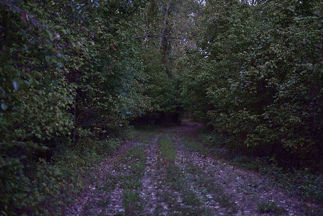
Is it pleasant, or frightening, in the dark? Perhaps both? We live in an age where nervous parents overly-protect their children, to the point where children become fearful and sickly because they are not exposed to the dangers of life — but this age also promotes exceptionally risky behaviors. Moral theologians instead remind us that the virtue of courage is built up by habitually taking measured risks, while never being either a coward nor foolhardy. Clearly, although the greatest dangers come from our fellow human beings, stumbling around in a forest at night has its own danger, not the least is poison ivy, which is seen growing here on both sides of the trail.
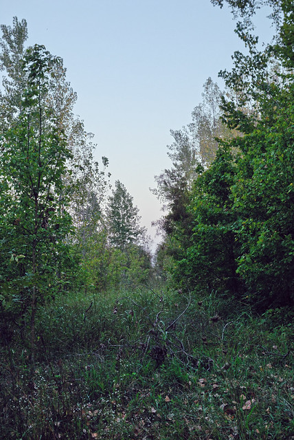
But it also has its own beauties. Even the commonplace becomes mysterious as dusk deepens.
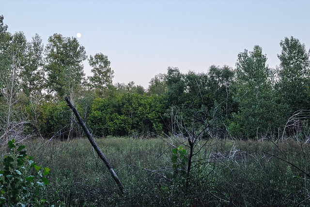
The full moon rises over a small clearing.
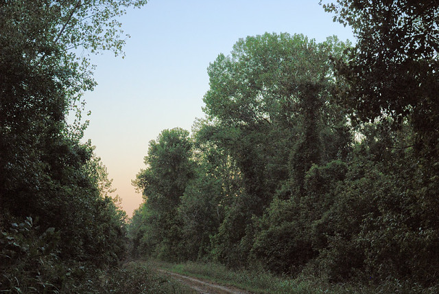
Wild grape vines climb into the trees here, near the river. On the opposite side of the river, in Saint Charles County, there are numerous wineries that take advantage of the good grape-growing conditions found hereabouts.
The problem with night photography is that the camera diligently works to make a well-exposed photo, and the results will likely look like broad daylight and not dusk — if, that is, you can get a photo at all due to the darkness. A tripod or special low-light camera gear can help. The human eye has a special low-light adaptation which gives a different appearance of tonality and color than does a camera. I've done some manipulation on these images to simulate that effect, which I describe in technical detail here, here, and here.
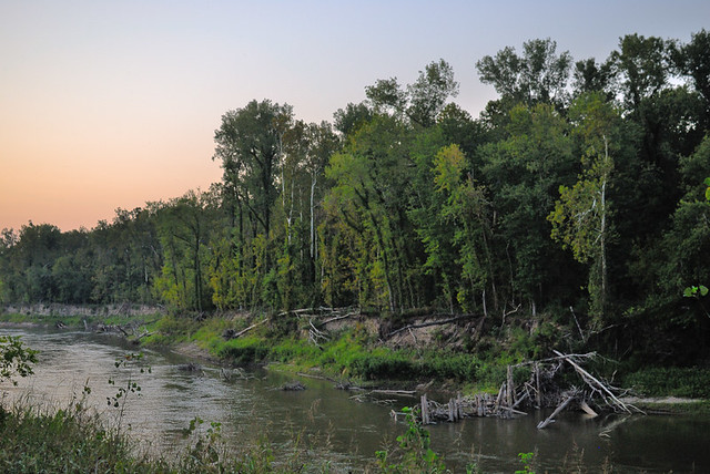
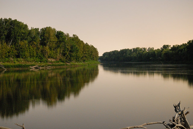
The river, after more than a mile's hike, with the remaining sunset giving a warm color to the sky.
This is — as far as I know — an unnamed chute, with Johnson Island in the background. Access to the island is only by boat from across the river, and you have to cross the rather treacherous Missouri River. Because the river has shifted in course since these areas were surveyed by the Spanish Crown, part of the island is in Saint Louis County, and other parts are in Saint Charles. There are several areas nearby where you can walk between the counties on land.
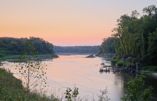
In the background is the main channel of the river.
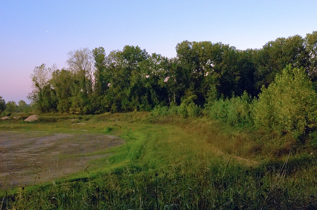
On the way back to the tiny parking area, these trees were illumined by the last bit of dusk and by lights from a sports field a half mile to the south.
The Howell Island Conservation Area is located nearby. Access to the island is by a low-water causeway, which was recently reconstructed. These photos were taken on the causeway, showing Centaur Chute, and the scene was illumined by moonlight and by distant city lights illumining the sky:
The stillness of this low water is contrasted by the rapids formed here during spring flooding.
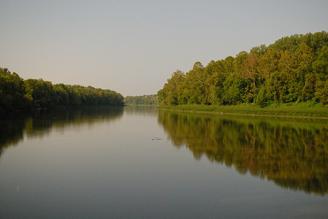
A restful scene to complete the evening.

No comments:
Post a Comment