
LAST SATURDAY, I went on a canoe trip at the Mingo National Wildlife Refuge, in the southeastern part of the state of Missouri, near the town of Puxico.
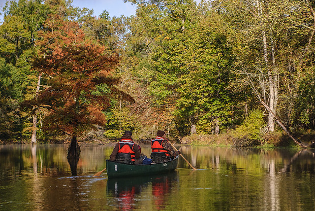
Autumn is perhaps the prettiest time of year in this part of the world, narrowly beating out Spring due to typically dry weather. This was a cold day — not the best for canoeing, due to the risk of capsize — but a beautiful one. The lack of mosquitoes and deadly vipers during this time of year makes a fall visit even more appealing.
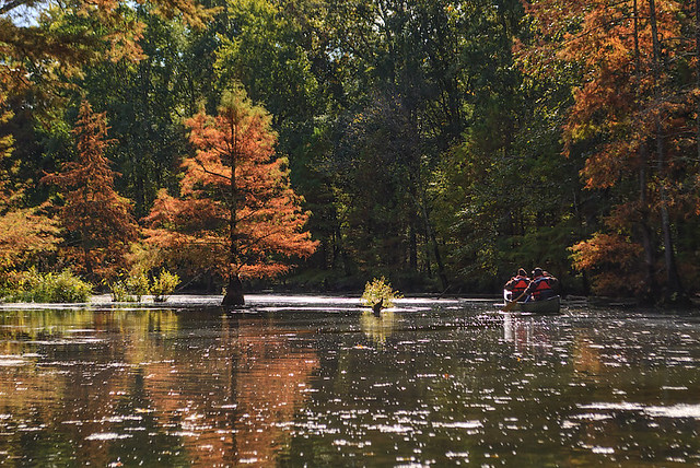
The Mingo River meanders through the Mingo swamp, which is a small remnant of a formerly much larger swamp that covered the lowlands near the Mississippi River, south of Cape Girardeau, Missouri.
Much of these lowlands were drained and logged a century or more ago, with the land now being used for crops. But flooding is always a concern here; nearly the entirety of nearby Mississippi County is sacrificed as a floodway when the waters get too high.
The land is flat and featureless, with only the nearby Crowley’s Ridge giving relief to the topography of the region. In the forest itself, it is quite easy to get lost, for all directions look the same, and the bends of waterways can trap the casual hiker.
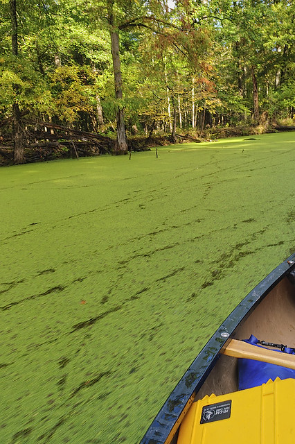
Duckweed, which is perhaps the smallest of all flowering plants, covers a stretch of the gently flowing river. The sound of the canoe pushing through the duckweed is not unlike the sound of a sled in snow.
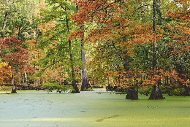
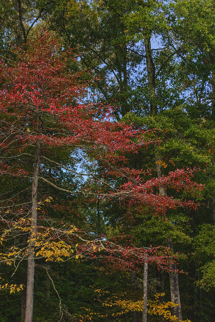
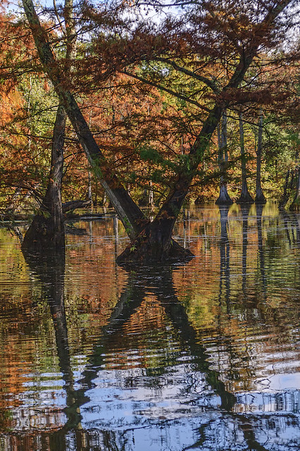
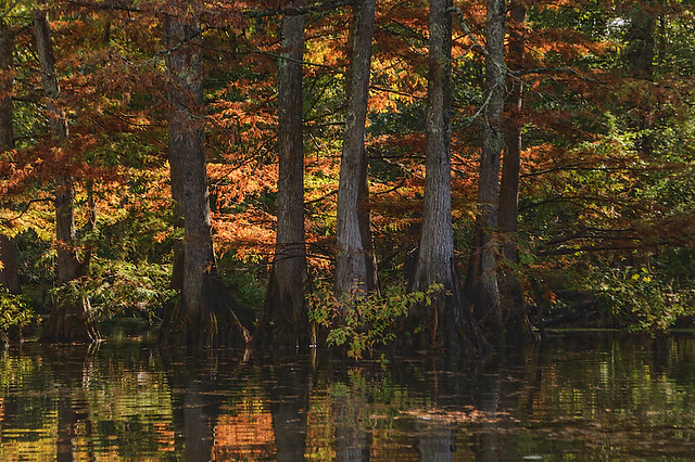
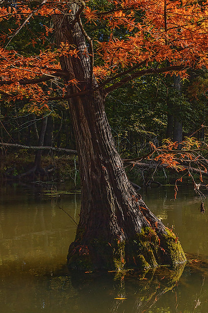
A common tree in these swamps is the Bald cypress (Taxodium distichum). While a relative of the evergreens, this cypress loses its leaves in the winter. The leaves turn a dull reddish-orange color in the Fall, as seen in these photos.
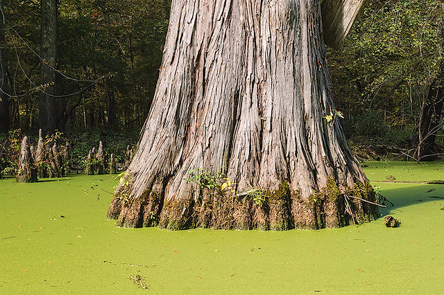
These cypresses have a distinctive wide base, as well as ‘knees’ that stick up out of the water around the base, as seen here. Some individual trees here are older than a thousand years. Cypress wood is valued because it does not rot when wet; in Europe, cypress and cedar (also found here) were valued for the construction of churches, as we find in the stave churches of Scandinavia. The First Jewish Temple of Solomon was constructed of these woods, imported from Lebanon.
Architecturally speaking, this is a much-neglected wood. And as it happens, cypress swamps are the most productive of all forestlands. As land can be inexpensive here, it would seem to be reasonably easy to reestablish larger cypress forests.
Tupelo trees, which also grow here in the water, have smoother, somewhat rounded bases.
These photos are best displayed on a dark background; click the photo to be taken to Flickr, where you can get a better view of them.
This is about the northernmost range of cypress, which is found throughout the Southeastern US. While it will grow farther north (many are planted in Forest Park, in Saint Louis), the tree does not reproduce well if it gets too cold.
Like the Nile delta in Egypt, the Mississippi River delta is vast, and relatively unknown to most Americans. Stretching for about 600 miles from southern Missouri, through Arkansas, Kentucky, Tennessee, and Mississippi, it ends in the swamplands of Louisiana at the Gulf of Mexico. While this region is heavily modified by humans, frequent flooding shows nature’s dominance.
The Mississippi River, which is placid and clear in its northernmost stretches, becomes deep, narrow, muddy, and swift, starting just north of Saint Louis at the river’s confluence with the Missouri River: this is also a dangerous stretch of river, where perhaps on average one steamboat wreck per mile can be uncovered, and many sunken modern barges can be see here in low water.
But after the confluence of the Ohio River — which forms the southern border of Illinois — the Mississippi becomes sluggish, laden with silt, and meandering, splitting off into innumerable islands, and bordered by vast swamps, even to this day. A major flood could cut off one part of a state and attach it to another, as we find in many places hereabouts, including one large part of Kentucky, located across the river from New Madrid, which is not connected to the rest of the state.
At about this point, Fr. Jacques Marquette, S.J., who explored this area for the King of France and the Church, in the year 1673, wrote:
“Here we Began to see Canes, or large reeds, which grow on the bank of the river; their color is a very pleasing green; all the nodes are marked by a Crown of Long, narrow, and pointed leaves. They are very high, and grow so thickly that The wild cattle have some difficulty in forcing their way through them."
Missouri is typically considered to be a midwestern state in culture, and central Missouri’s dialect is the standard for national journalism in the USA. But the southeastern part of the state shows its historic southern roots as accents and other artifacts of culture change quickly the farther south you travel.
It is in this region that developed the distinctive American style of music known as the Blues, which greatly influenced popular styles of music worldwide. Here we find both fertile soil and great poverty; mixed with Calvinist religion, we then have a culture and its music which is haunted by the Devil, in every impenetrable swamp and at every crossroad. Singing the Blues, they say, gives you the blues.
But this was a pleasant and beautiful day, helped by an expert guide and pleasant company.

No comments:
Post a Comment