
But about eleven river miles north of the original settlement of Saint Louis, and five miles south of the confluence with the Missouri, is the Chain of Rocks; a bedrock exposure that prevented navigation on the river. Boats had to unload at Saint Louis, and cargo moved overland to Saint Charles, on the Missouri River, via what is now known as Olive Boulevard. Then transportation could be resumed to points north and west.

A water intake structure, built in 1891, sits just upstream from the Chain of Rocks. Directly south is downtown Saint Louis, Missouri, which appears to be to the left of the river; however, the river bends to the west before reaching downtown.
Victorian engineers were not utilitarian in their designs; like much of the technology of that period, this structure has great beauty.
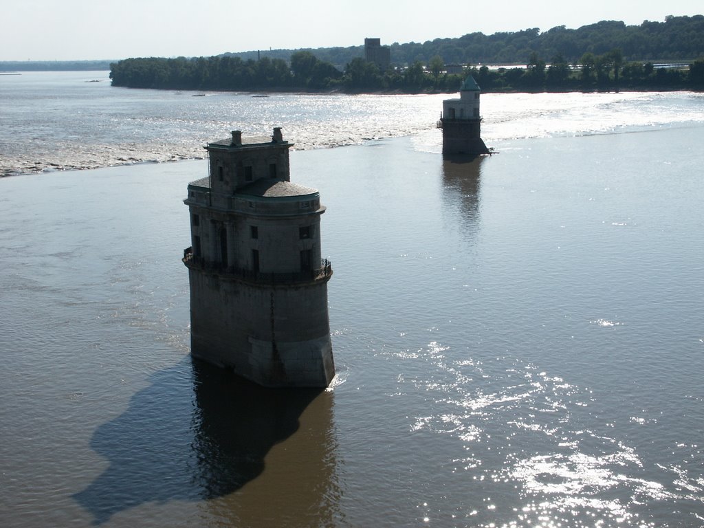
Both water intakes are seen here. These photos were taken from the Chain of Rocks bridge, now a bicycle and pedestrian bridge, on September 1st, 2001. In the background is the Chain of Rocks water treatment plant. This half of the river has water from the Missouri River, there is no significant mixing of the waters until many miles downstream: this is fortunate, since the Illinois River, which joins the Mississippi 27 miles upstream from here, is the sewer for the City of Chicago.
The Chain of Rocks is artificially enhanced, and is also known as Dam #27, the final dam on the Mississippi River. It is open river from here all of the way to the Gulf of Mexico. No navigation at all occurs here, outside of bold or foolish kayakers; the Army Corps of Engineers dug a canal bypassing the Chain of Rocks, and includes a lock. The Mississippi River from this point down to the Ohio River is swift, narrow, and dangerous; by the late 19th century there was on average one steamboat wreck per mile along that stretch of the river. North of here, the river is wide and serene, and is popular with pleasure boaters.
The turbulence from the Chain of Rocks attracts many unusual species of fish, including the gar and sturgeon.
The first European explorers of this area, Joliet and Marquette, were terrified at the confluence of the Rivers: entire forests of trees were washed down the Missouri, forming enormous rafts of wood that made a terrible din. It wasn't until the 1880s that the Federal Government took steps to make the Missouri River safe for navigation, but by that time, the age of the steamboat was over, and the railroads ruled transportation west.

No comments:
Post a Comment